What is the meaning of a map? A map to most people would be a representation of an area of land or sea, showing physical features, cities, roads, etc.
A map can also be a diagram or collection of data, a representation of a sequence, or a two-dimensional or three-dimensional interpretation of information.
A map can also be a diagram or collection of data, a representation of a sequence, or a two-dimensional or three-dimensional interpretation of information.
Some Examples of Maps:
1. Political Maps
1. Political Maps
- A political map shows the state and national boundaries of a place. A political map does not have any topographic features.
- It also shows the location of cities, with respect to each other.
- A physical map is one which shows the physical features of a place or country, like rivers, mountains, forests and lakes.
- The physical features are usually shown in different colors.
- Rivers and lakes are shown in blue, places of low elevation are shown in dark green and as the elevation increases, the color becomes light green and eventually orange.
- Mountains are shown in brown.
- Topographic maps are similar to physical maps, which show the physical features of an area. Although in topographic maps, differences in elevation and changes in landscape are shown with the help of contour lines and not colors.
- A climatic map shows the information about the climate of different areas.
For example it shows areas which receive more rainfall or snow, or which have dry weather. - It uses colors to depict areas with different climate.
- Economic or resource maps show the different resources present in the area or economic activity prevalent.
- They show the kind of crops that are grown and the minerals found in places.
- Symbols and letters are used to depict the activity or resource present in the area.
- Road map is the most widely used map which shows different roads, highways or railways present in the area.
- It is a very detailed map and is generally used for direction purposes.
- Road maps are usually made individually, city-wise.
- There are road maps present for an entire country too, but they cannot be made very detailed.
- The scale of a map shows the relationship between the distances on the map with respect to actual distances on the Earth. For example if the scale of a map is 1 cm to a kilometer, that means 1 cm on the map is equivalent to 1 kilometer on actual ground.
- Using a scale you can quite accurately measure the distance between 2 places.
- On maps different symbols represent different things, for example black dots represent cities, circled stars represent capitals.
- Different types of lines represent roads, highways and railways.
- Trees and forests are depicted in green, mountains in brown and rivers and lakes in blue.
- This done for making it easier for us to spot these features and study the map.
Decide what you are going to make:
The options are endless!
Tri-fold brochure of places you would like to visit
Map of a journey to space
Treasure map of a secret island
Map of climate change over the past 10 years
A poster advertising a tour map of a country (big bus)
Map of ocean levels increasing over 5 years
Map of a journey to space
Treasure map of a secret island
Map of climate change over the past 10 years
A poster advertising a tour map of a country (big bus)
Map of ocean levels increasing over 5 years
Make a google doc called "Map" and share it with [email protected]!
Include the following:
1. What type of map will I be making:
2. What type of product will I be organizing?
ex. poster, tri-fold brochure, greeting card, t-shirt advertisement, coffee mug design ad, etc!
3. What fonts will I use?
(2 max unless very specific reason)
a.
b.
4. Reference Images (2 min)
Find a reference image for the visual hierarchy you will be using as well as the style you are going for!
5. Color Harmony?
(3 max & shades/tints unless very specific reason)
list:
6. 2 Sketches of Ideas!
Examples Student/ Professional:
Design an Illustration that contains a map:

|

|
Create a map of a made up or fantasy place:

|

|
Design something new or fictional with a blue print:

|

|
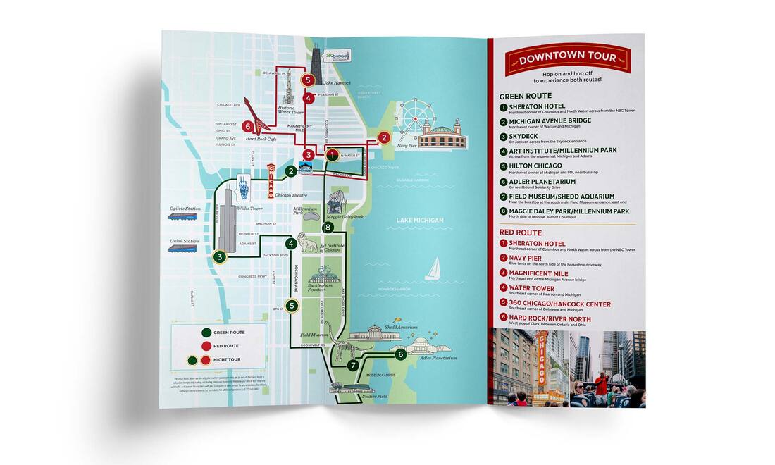
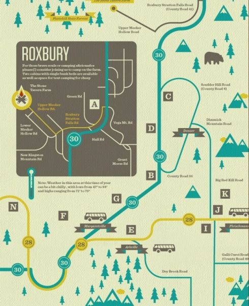
Design a 3 Fold Brochure map:
|

|
Map out fashion styles:

|

|
Create a mind map:

|

|

|
Create a word map:

|

|
Use a map as decoration in product design:

|
|

|
Create a map for a theme park or event space:

|

|

|
Design a map of a place that exists:
|

|
Making something like this and turning it into an advertisement:

Market a new phone app!


